Anguilla is known for its vibrant coastal waters with coral reefs and sandy beaches. But its exclusive economic zone (the area of sea Anguilla is responsible for) is vast. Stretching almost 200 nautical miles north-east of the island, much of it had never been scientifically surveyed. However, 25 scientists and technical officers from Anguilla and the UK have been working hard to change that.
On board the RRS James Cook, the team ventured from the South-Western Approaches to as far as the Sombrero Trough collecting valuable data as they went. Over 10 days at sea, the crew achieved an impressive amount:
- Mapped over 2000 km2 of seafloor
- Processed nearly 2000 litres of water, from depths of up to 5515 metres
- Analysed fish populations across the Malliwana, Anguilla and Crocus Banks
- Identified 2141 specimens in offshore waters from over 1000m depth
- Took over 10,000 photos of seafloor and open water habitats
Before the expedition, little research had been conducted beyond Anguilla’s coastal region. Investigating further and deeper waters is near impossible without access to the right vessels and equipment. As a result, much of Anguilla’s offshore waters have never been surveyed. This lack of data greatly limits scientific understanding of Anguillan waters. The data collected during this leg of the expedition is filling data gaps to provide a baseline that can be used to determine the effects of climate change and pollution.
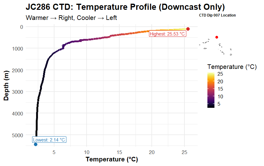
Scientists analysing how temperature, salinity, oxygen and chlorophyll change with depth.
Although this leg is over, it's only the beginning. Scientists will now begin analysing the data to begin piecing together a detailed picture of the geography, habitats and ecology of Anguilla’s offshore waters. This wealth of information will give Anguilla the evidence they need to strengthen efforts to manage and conserve their marine environment.
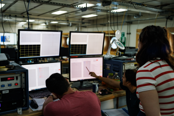
Data Collection
The Beyond the Reef Caribbean Expedition is a 24-hour operation. Multiple methods of data collection have been employed to gain a holistic understanding of Anguilla’s offshore waters. This expedition is incredibly exploratory. It’s the first time that data has been collected in almost all the regions visited.
Multibeam
Before the Beyond the Reef Caribbean Expedition, our understanding of seabed topography was based off of satellite data. However, this can be hundreds of metres off. Multibeam uses sound waves to make detailed maps of the seabed. These maps will help the Government to understand seabed topography, biodiversity composition, and any potential navigational hazards to ships and boats.
Fisheries Acoustics
This method uses sound to characterise the abundance and distribution of pelagic fish. Survey areas included key fishing grounds and the locations of selected Fish Aggregating Devices (FADs) across the Anguillan, Crocus and Malliwana Banks. This data will support assessments of the health and status of key fisheries.
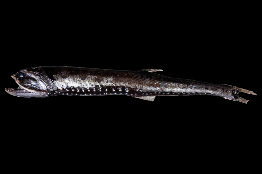
Mid-Water Trawl
The first samples of Anguilla’s offshore waters pulled up an array of shrimp, glowing lantern fish and alien-looking cephalopods. Many of which have never been recorded in the Caribbean before.
The mid-water trawl net can be opened at two specific depths. It will be deployed to sample small fish and molluscs that inhabit open water at depths between 200 and up to 1500 metres (approximately 650-3,300ft).
Water Quality
Water samples have been taken in nine locations. The chemistry team have sampled almost 2 tonnes of water taken from up to 5500m depths! These samples will be analysed to monitor local and external pollution threats including plastics, and nutrients. These measurements will help to understand how Anguilla’s marine environment could be impacted in the future.
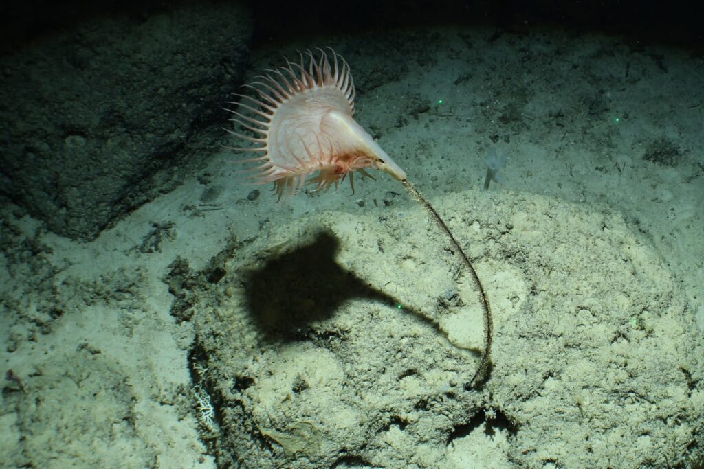
Seafloor Camera
Over 10,000 photos and over 200 hours video have been taken of the seabed using three different camera systems. These images have revealed previously hidden seabed habitats and allow us to observe the species that reside there.
Collaborative research
None of this science would be possible without the support of the Anguillan crew. The science plan was developed in collaboration with the Department of Natural Resources, Blue Anguilla Ocean Governance Committee and marine stakeholders. This ensured that the data collected would be beneficial to multiple stakeholders in Anguilla.
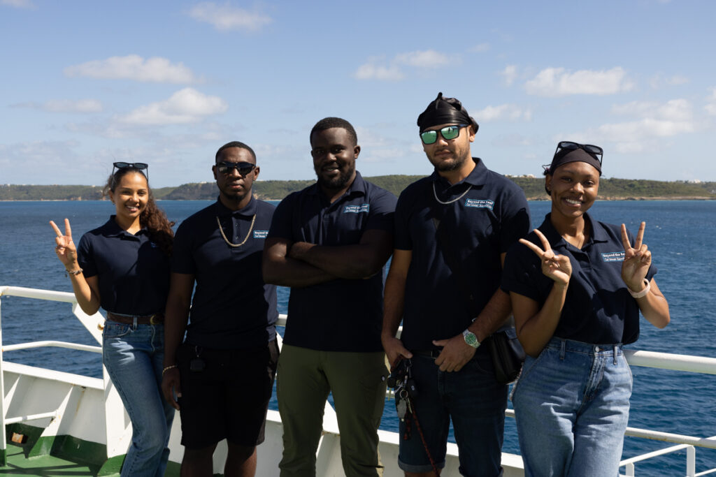
Five technical officers from the Government of Anguilla joined the crew. Jasmin Ruan, Vincent Webster and Jasmine Alcantara represented the Department of Natural Resources and Ricardo Rock and Jordel Hodge joined from the Department of Land and Surveys. The input of the Anguillan crew has been paramount to the success of this first leg.
Whilst they have had a chance to learn new skills to support their work, their insights into the local environment have helped to guide the research priorities and provide an extra layer of importance to our findings. Additionally, they will now take this data to begin shaping the future direction of Anguilla’s marine environment.
Ricardo Rock who is a land surveyor on Anguilla, will be staying on for the duration of the expedition. Usually, he uses GPS, drones, and Lidar techniques (involving rapid laser pulses) to create high resolution maps. However, he is remaining on the entirety of the expedition working with mapping experts from the UKHO to better understand multibeam techniques and how to process and interpret the data to map the seafloor. Multibeam uses pings of sound that bounce off the seafloor to make maps.
" Its been really insightful and educational. Hydrography is something I've always wanted to specialise in. This is an opportunity to broaden my expertise as a surveyor and become more of an asset for Anguilla and the region." Ricardo Rock, Surveyor for the Department of Lands and Surveys
From this experience, he will be able to support Anguilla in inshore mapping to ensure safe navigation and guide the development of future marinas and docks. Additionally, he will work with the other island teams from the Turks and Caicos Islands and the Cayman Islands. It’s an opportunity to gain valuable insight into common challenges and how each of the UK Overseas Territories manages and conserve their waters.
What's next
The RRS James Cook is currently steaming its way through the Caribbean Sea towards the Turks and Caicos Islands. Here we’ll be welcoming a new crew of local researchers on board and beginning our next leg to advance marine science in this region.
More about the Blue Belt Programme
Since 2016, the Blue Belt Programme has worked closely with UK Overseas Territories to enhance the protection and sustainable management of their marine environments, establishing nearly 4 million square kilometres of marine protected areas. The Government of Anguilla has been a partner of the programme since 2023.
This expedition builds on the success of previous missions, including the Discovery 159 survey to the Atlantic islands of Ascension and St Helena in 2022 – which saw the discovery of two new seamounts and some of the first recordings of cold-water coral reefs at a depth of 1,000 metres.
1 comment
Comment by William Forsythe posted on
Very insightful blog. Thanks.